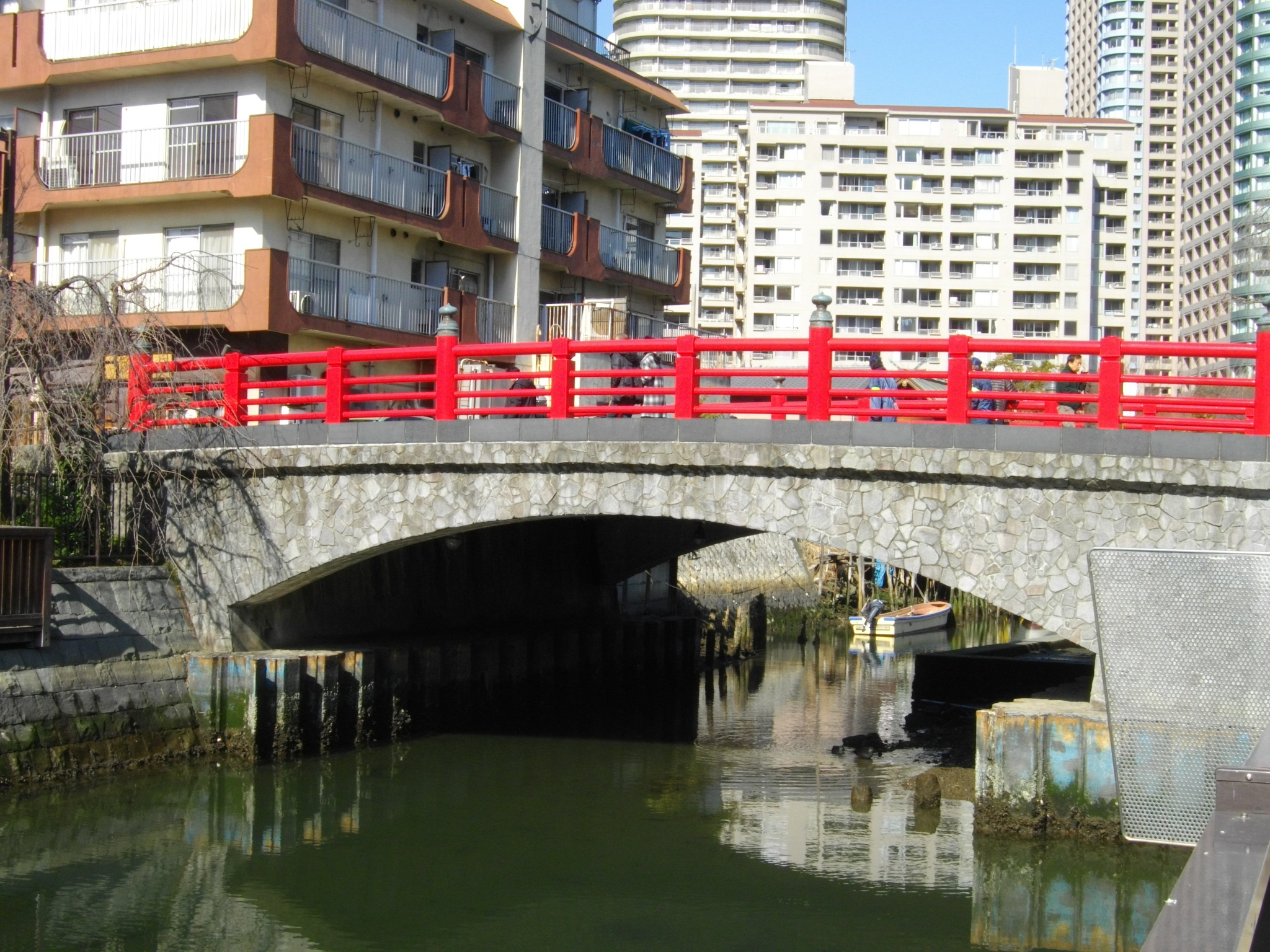
Tsukuda Kobashi
Tsukuda Kobashi is a small vermilion bridge over Tsukudabori, the boat basin at the heart of Tsukuda; the present span dates from 1984, though a crossing has stood on roughly this line since the island was completed in the 1640s. From the middle of it you see moored boats and low tiled roofs in front and the towers of Okawabata River City 21 directly behind.
Start on the bridge itself. From Tsukishima station, on the Yurakucho and Oedo lines, it is a few minutes north through the alleys, and from here the whole walk runs about seventy-five minutes: eight stops, roughly two and a half kilometres, flat ground, no entry fees, and lanes narrow enough that cars mostly give up. One thing to hold onto for the next hour: almost everything you are about to look at is somebody's home. Walk the alleys quietly, and do not photograph anyone's doorway. Stand in the middle of the span and look down the water.
What you are looking at is Tsukudabori, the boat basin. It is really the dead-end stub of a channel called the Tsukudagawa Shikawa, left behind when the rest of the waterway was filled in. Small boats are tied along both stone walls, hulls sitting low. Behind them are tiled roofs and two-storey houses at a height nobody builds at any more in central Tokyo, laundry out, air conditioners bolted to the walls. And rising straight up behind those roofs are the towers of Okawabata River City 21. Old kitchen, new skyline, in one frame. You do not need me to explain that view; you can simply look at it.
The bridge under your feet is younger than it pretends to be. This version was completed in 1984, and the red-lacquered railings, the onion-shaped giboshi finials on the posts and the stone arching along the sides are all deliberate period dress. But a crossing has run on roughly this line since the island was finished in the 1640s. A 1679 survey map of Edo already shows the moat splitting Tsukuda into an eastern and a western half, with a bridge about where you are standing.
Now look over the rail at the mud, and find the sign the Tsukuda Sumiyoshi-ko put up. Something is buried down there, and it comes out of the riverbed once every three years. The shrine two minutes from here will tell you what it is and why the mud is the right place to keep it — it is a very Tsukuda answer to a problem, and it deserves to be heard standing in front of the people who still do it.
That is the thread of the whole walk. Nothing about this ground is natural. The island beneath you was made, out of tidal flats, by people who had themselves been moved here from somewhere else, and having been handed a low, awkward patch at the mouth of the Sumida on the far side of the city, they turned what they had into what Edo needed. Watch that habit repeat for the next hour.
Being on the far side mattered longer than you would guess. Until 1964 there was no road bridge here at all; you reached Tsukuda by boat, and we will get to how that ended. A few stops from now, out on the embankment, this same contrast gets sharper still, and we finish the walk on a bridge a great deal bigger than this one.
And if there are people with short rods along the wall, leave them to it — they are after goby, which tells you the water here is still alive.
Sumiyoshi Shrine, Tsukuda
That is stop one, in the walk itself. The remaining 7 stops, the map and the route between them open with one free account.
Continue the walkThe written walk is free.
Thank you! Your report has been submitted.
Report an issue
Help us improve by reporting any issues you notice.